Representative Project
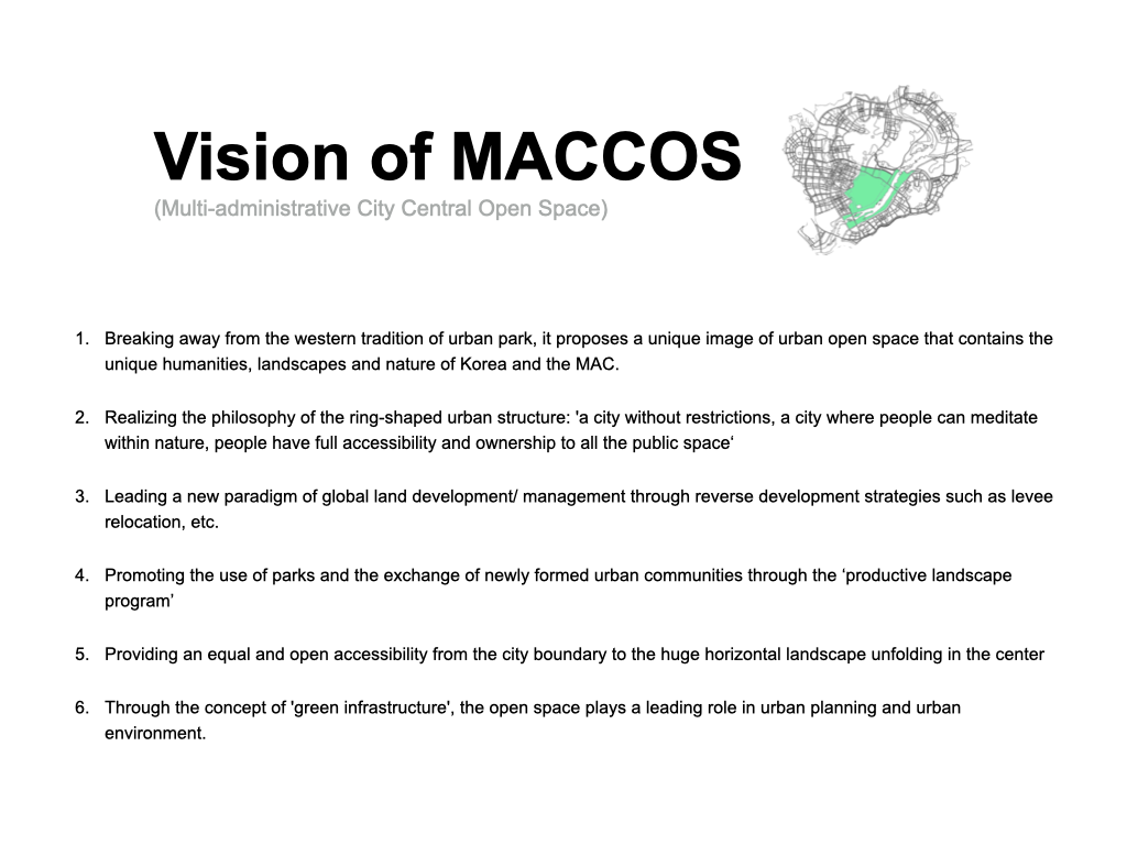
MACCO, 행정중심복합도시 중앙녹지공간 기본계획 및 기본설계(2007~2019)
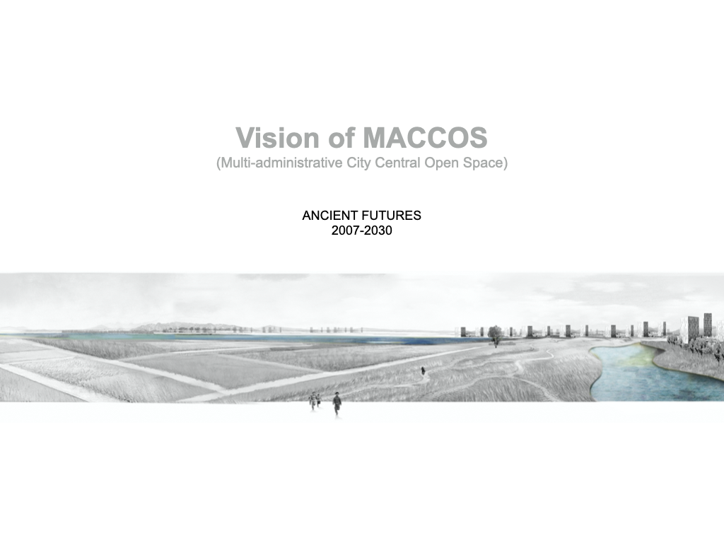
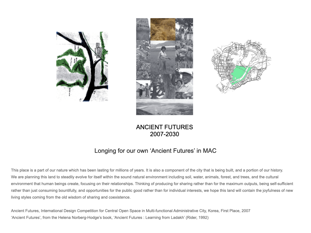
Longing for our own ‘Ancient Futures’ in MAC
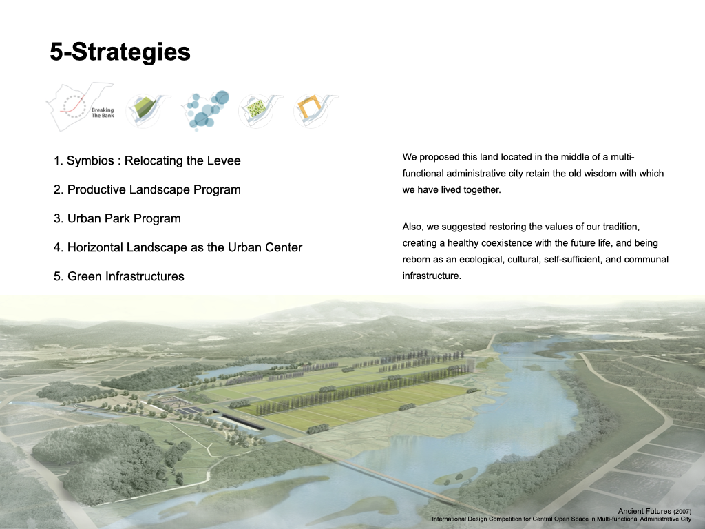
This place is a part of our nature which has been lasting for millions of years. It is also a component of the city that is being built, and a portion of our history.
We are planning this land to steadily evolve for itself within the sound natural environment including soil, water, animals, forest, and trees, and the cultural environment that human beings create, focusing on their relationships. Thinking of producing for sharing rather than for the maximum outputs, being self-sufficient rather than just consuming bountifully, and opportunities for the public good rather than for individual interests, we hope this land will contain the joyfulness of new living styles coming from the old wisdom of sharing and coexistence.
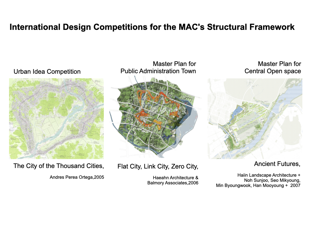
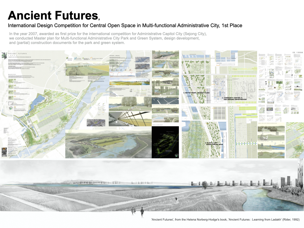
Ancient Futures, International Design Competition for Central Open Space in Multi-functional Administrative City, Korea, First Place, 2007
‘Ancient Futures’, from the Helena Norberg-Hodge’s book, ‘Ancient Futures : Learning from Ladakh’ (Rider, 1992)

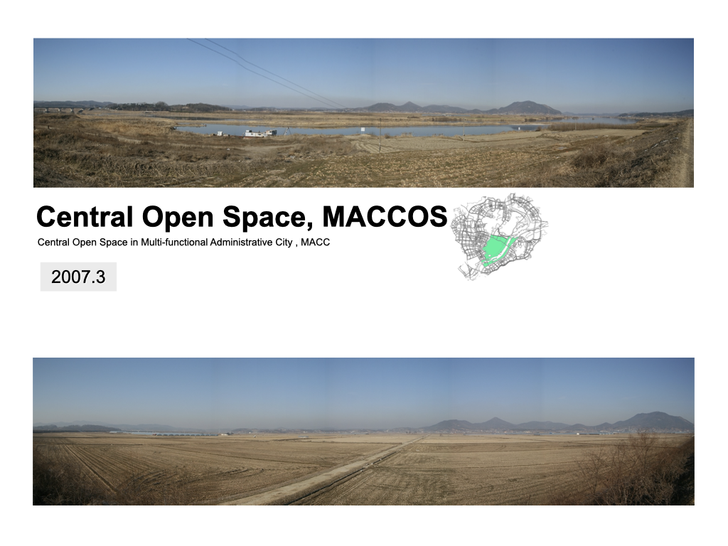
Central Open Space in Multi-functional Administrative City(Sejong City), KOREA : “ANCIENT FUTURES” / 2007 – 2012, 2014 – 2016, 2017 ~
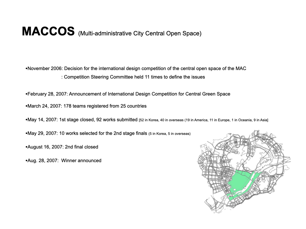
1st Place (97 Teams, International Design Competition)
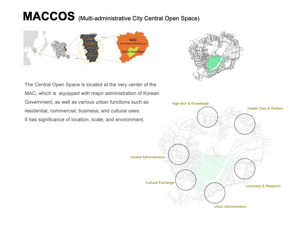
– Location : Central Area in Sejong City, Korea
– Type : Urban Planning, Site Plan, Landscape Design
– Scope of Work : Urban Planning, Land use Plan, Landscape Design, SD, DD, CD
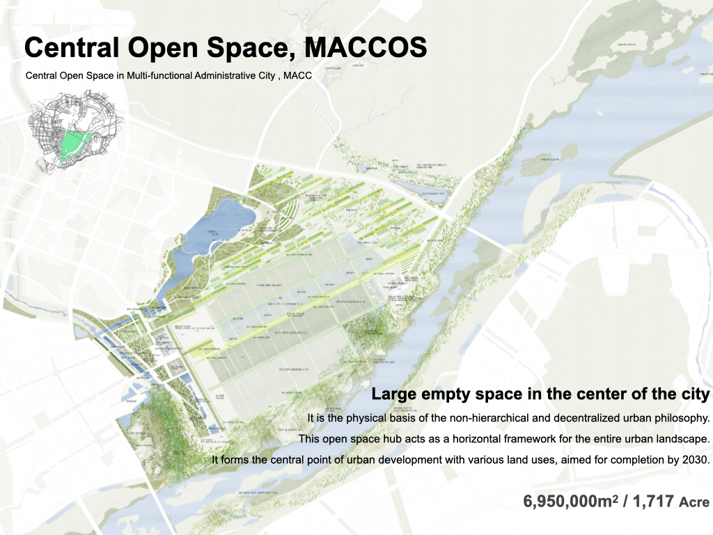
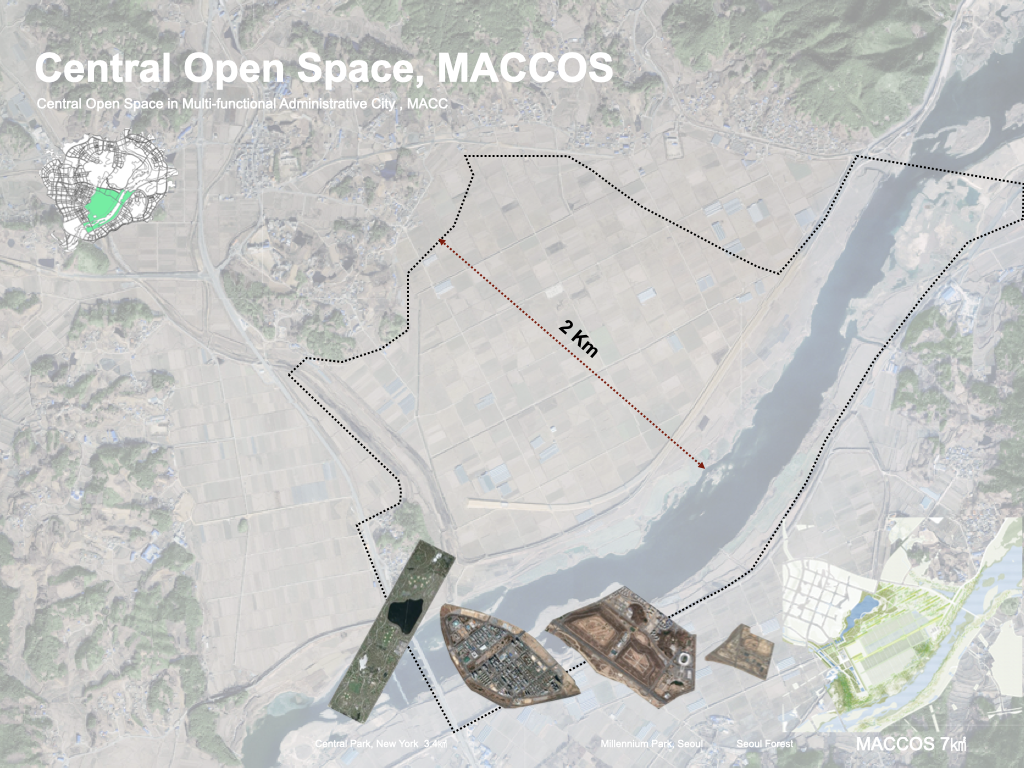
– Area : 6,950,000m2 / 1,717 Acre
– Client : MACCA(Multi-Functional Administrative City Construction Agency), LH (Korea Land & Housing Company)
– Year, Built : 2007 – 2012, 2014 – 2016, 2017 ~ / Built, Not Built Yet

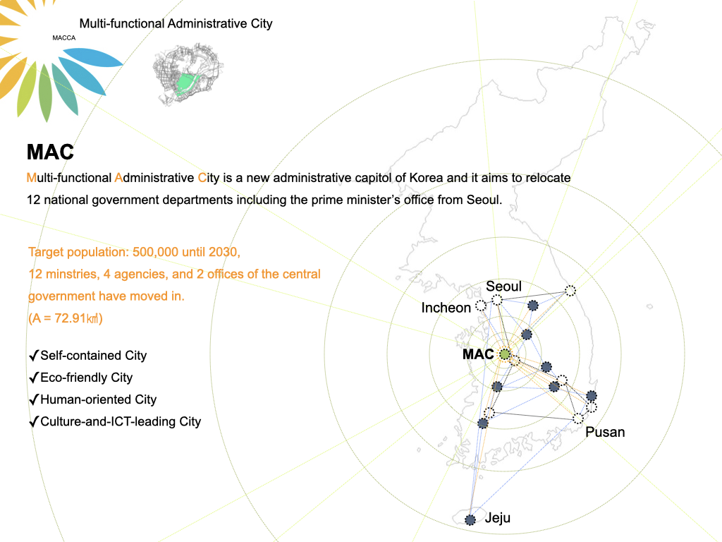
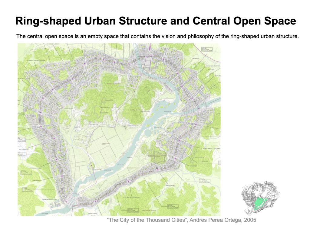
Sejong City is a new administrative capitol of Korea and it aims to relocate 12 national government departments including the prime minister’s office from Seoul.
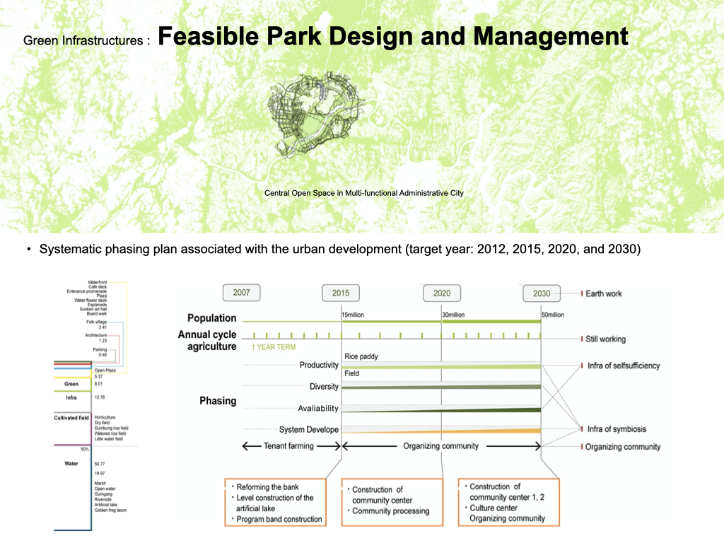
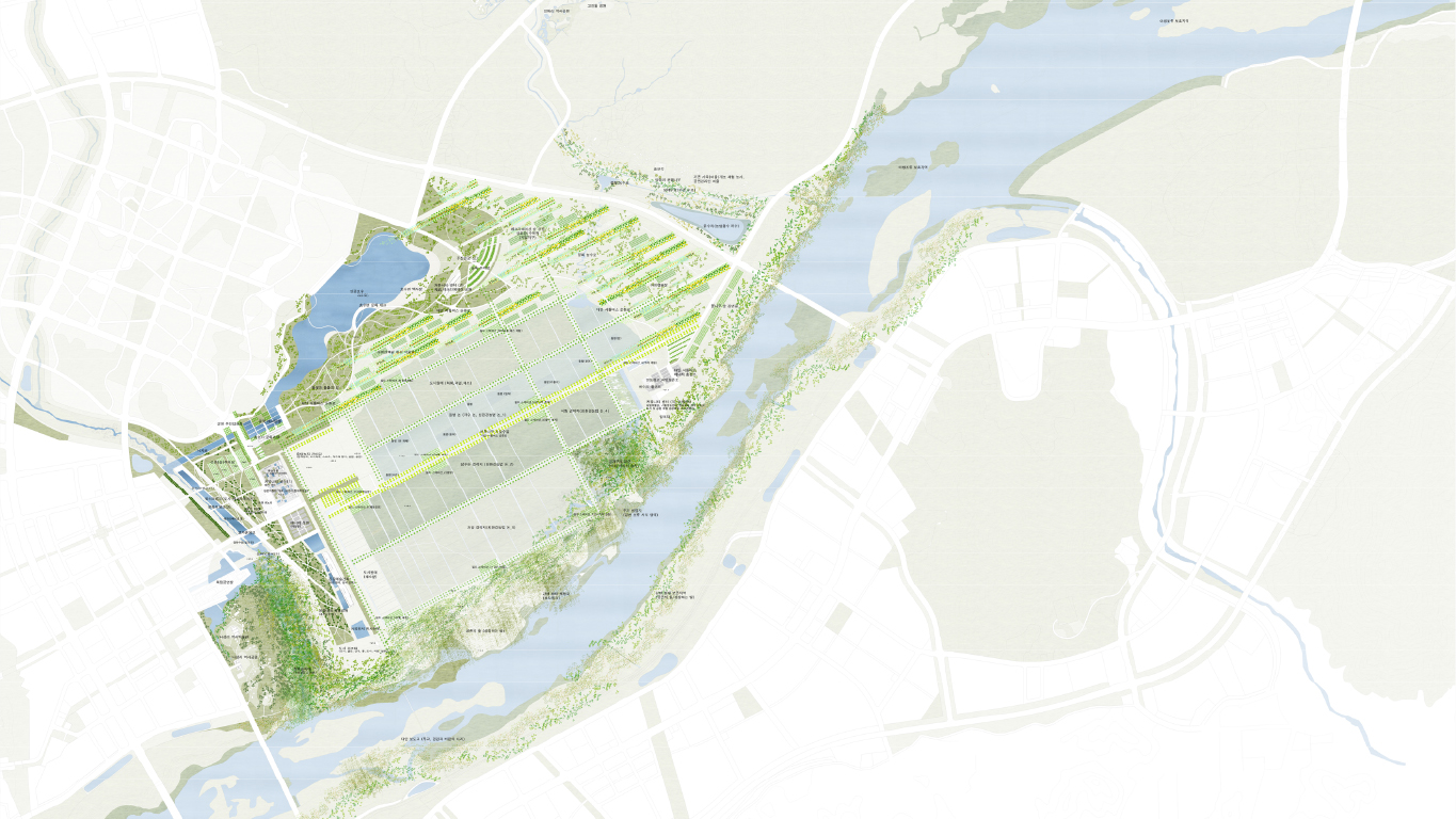
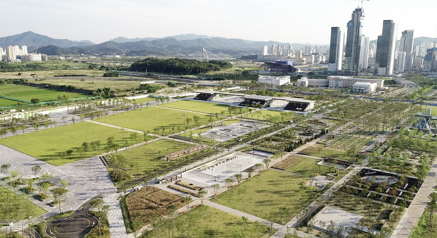
We won the first prize in the international competition for Sejong Central Park in 2007. This park is approximately 6,950,000 m2 making it the second largest urban park in the world. Delivering from master plan to construction documents, which took 5 years, we demonstrated our sustainability by proposing a long term park construction system with 3 phases to compete the park system in 2030 to allow future generation’s participation.
In the year 2007, awarded as first prize for the international competition for Administrative Capitol City (Sejong City), we conducted Master plan for Sejong City Park and Green System, design development, and (partial) construction documents for the park and green system.

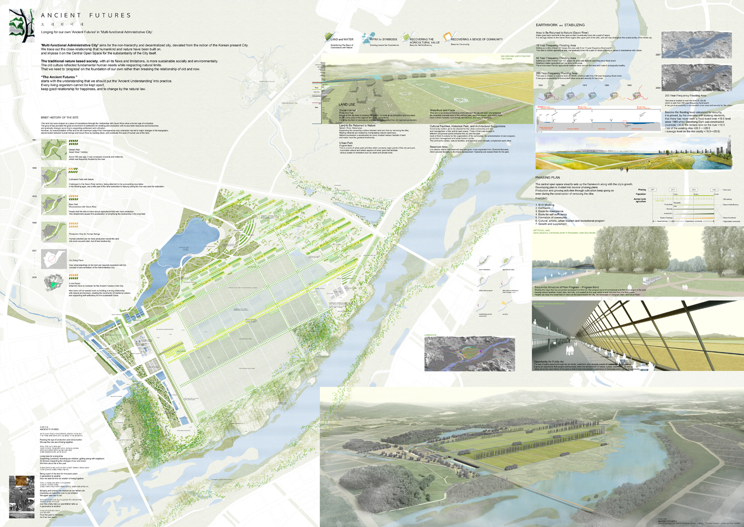
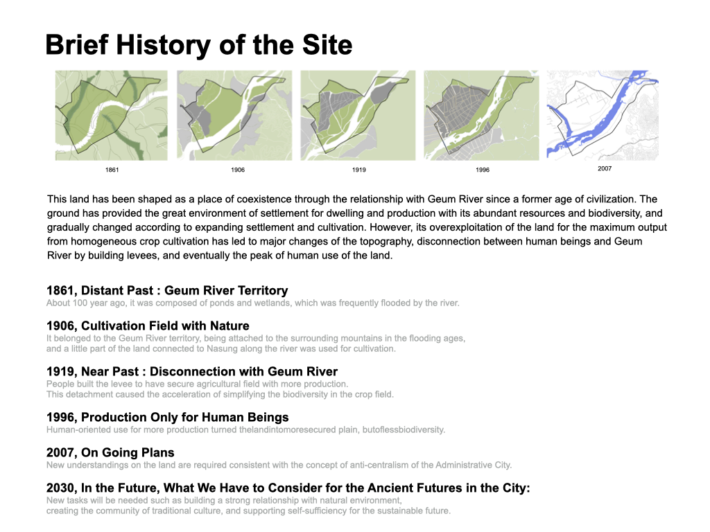
BRIEF HISTORY OF THE SITE
농경지로 변모되기 오래 전, 이 땅은 수만년의 시간을 통해 금강과의 밀접한 과정을 거쳐 그 형상이 만들어졌다. 드넓은 평야라는 지형적 특징을 지닌 이 땅은 주거 공간과 생산 공간이 공존하기에 매우 적합하였다. 장남들은 수많은 자연적인 연못과 습지를 포함하여 ‘둠벙뜰’로 불리웠으며, 전국적으로 통용되고 있는 ‘둠벙’의 어원을 제공한 천혜의 생태보고였다. 다양하고 풍성한 자연 환경을 보유한 이땅은 생산의 효율만을 강조한 결과 최대의 수확만을 위한 거대하고 단조로운 지형으로 변하고 말았다. 제방에 의해 인간과 금강이 단절되고, 인간과 자연이 서로 소외되는 결과를 낳게 되었다. 또한 댐의 건설과 영농 등을 위한 제방정비와 하도정비에 따라 물의 흐름이 점차 단순화되었고 종다양성 또한 단순화되는 방향으로 진행되어 왔다.
This land has been shaped as a place of coexistence through the relationship with Geum River since a former age of civilization. The ground has provided the great environment of settlement for dwelling and production with its abundant resources and biodiversity, and gradually changed according to expanding settlement and cultivation. However, its overexploitation of the land for the maximum output from homogeneous crop cultivation has led to major changes of the topography, disconnection between human beings and Geum River by building dikes, and eventually the peak of human use of the land.

1919년 일제 강점기로부터 본격적으로 정주공간이 확장되고 생산의 효율만을 강조한 결과 제방의 축조가 이루어지기 시작하였고, 점진적으로 최대의 수확만을 위한 거대하고 단조로운 지형으로 변하고 말았다. 제방에 의해 사람과 금강이 단절되고, 전통적 풍수사상과 더불어 길한 땅으로써 상서로운 기운과 널리 연결되었던 맥이 끊기게 되었다. 풍성하였던 자연환경은 단순화 되었고, 산과 들과 물이 만나 조화를 이루었던 공존의 전통적 가치가 단절되게 되었다.
1861, Distant Past : Geum River Territory
About 100 year ago, it was composed of ponds and wetlands, which was frequently flooded by the river.
1906, Cultivation Field with Nature
It belonged to the Geum River territory, being attached to the surrounding mountains in the flooding ages, and a little part of the land connected to Nasung along the river was used for cultivation.
1919, Near Past : Disconnection with Geum River
People built the dike to have secure agricultural field with more production. This detachment caused the acceleration of simplifying the biodiversity in the crop field.
1996, Production Only for Human Beings
Human-oriented use for more production turned thelandintomoresecured plain, butoflessbiodiversity.
2007, On Going Plans
New understandings on the land are required consistent with the concept of anti-centralism of the Administrative City.
2030, In the Future, What We Have to Consider for the Ancient Futures in the City:
New tasks will be needed such as building a strong relationship with natural environment, creating the community of traditional culture, and supporting self-sufficiency for the sustainable future.

충청-전라-경상의 물이 합쳐지던 상서로운 물길과 땅으로써 ‘세거리’, 금강을 대체하는 ‘삼기강’의 별칭으로써 불리워졌던 물길 역시, 제방의 축조로 인하여 흐름이 단순화 되었고, 과거 이곳의 땅과 물이 보유하였던 풍부한 자연환경이 파괴되는 결과를 초래하였다. 연결성을 잃었기에 삼기강은 수만년을 이어 온 자연성과 수천년을 이어 온 전통적 지위를 상실하였고 경작을 위한 용수의 공급과 강우시의 빠른 배출을 위한 거대한 배수로의 역할로써 단순화 되게 되었다.
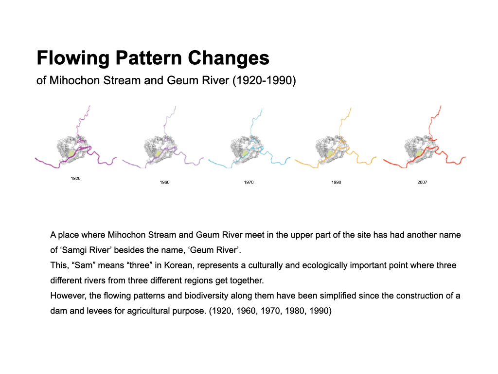
Flowing Pattern Changes of Mihochon Stream and Geum River (1920-1990)
A place where Mihochon Stream and Geum River meet in the upper part of the site has had another name of ‘Samgi River’ besides the name, ‘Geum River’. This, “Sam” means “three”in Korean, represents a culturally and ecologically important point where three different rivers from three different regions get together. However, the flowing patterns and biodiversity along them have been simplified since the construction of a dam and dikes for agricultural purpose. (1920, 1960, 1970, 1980, 1990)
LANDFORM / FLOOD EVENTS
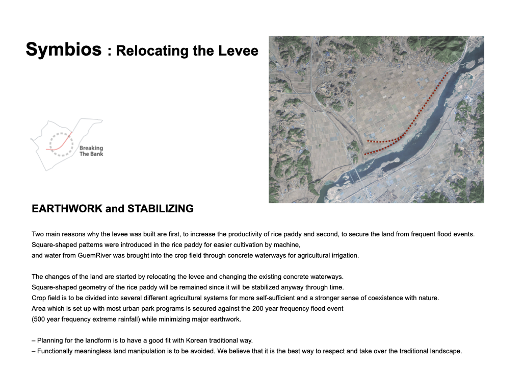
EARTHWORK and STABILIZING
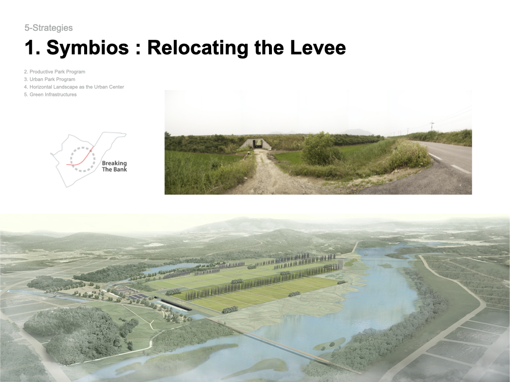
Two main reasons why the dike was built are first, to increase the productivity of rice paddy and second, to secure the land from frequent flood events. Square-shaped patterns were introduced in the rice paddy for easier cultivation by machine, and water fromGuemRiver was brought into the crop field through concrete waterways for agricultural irrigation.
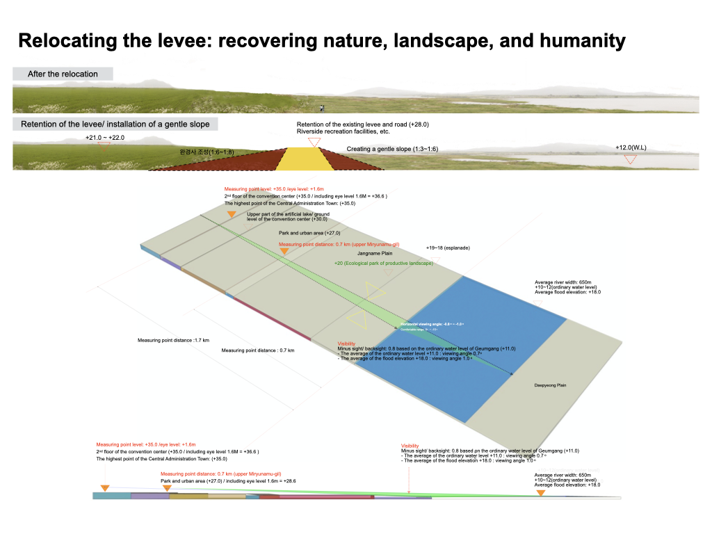
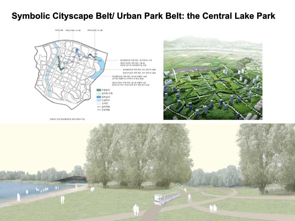
The changes of the land are started by removing the dike and changing the existing concrete waterways. Square-shaped geometry of the rice paddy will be remained since it will be stabilized anyway through time. Crop field is to be divided into several different agricultural systems for more self-sufficient and a stronger sense of coexistence with nature. Area which is set up with most urban park programs is secured against the 200 year frequency flood event (500 year frequency extreme rainfall) while minimizing major earthwork.
– Planning for the landform is to have a good fit with Korean traditional way.
– Functionally meaningless land manipulation is to be avoided. We believe that it is the best way to respect and take over the traditional landscape.
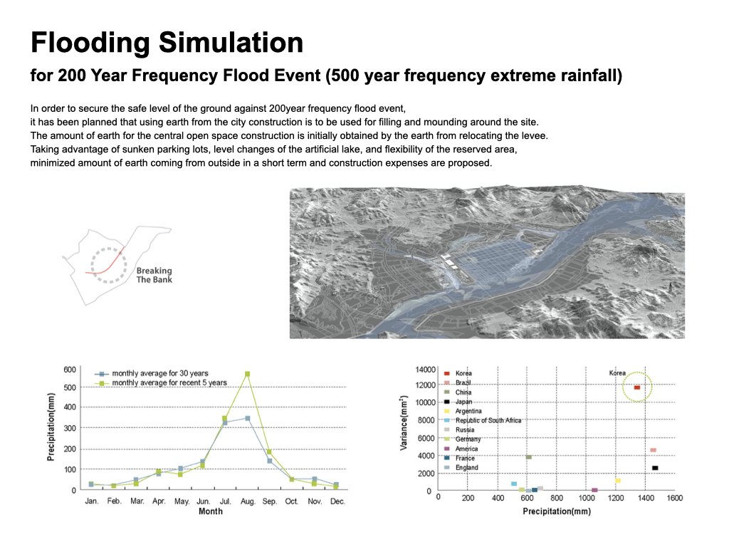
Flooding Simulation for 200 Year Frequency Flood Event (500 year frequency extreme rainfall)
Inordertosecurethesafelevel of thegroundagainst 200yearfrequencyflood event, it has been planned that using earth from the city construction is to be used for filling and mounding aroundthesite. Theamount ofearthforthe central open space construction is initially obtained by the earth from removing the levee.
Taking advantage of sunken parking lots, level changes of the artificial lake, and flexibility of the reserved area, minimized amount of earth coming from outside in a short term and construction expenses are proposed.
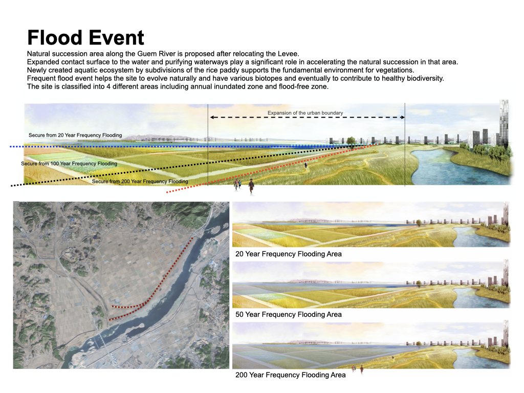
Flood Event
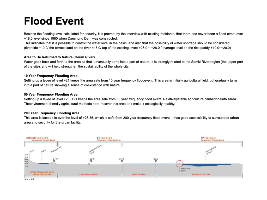
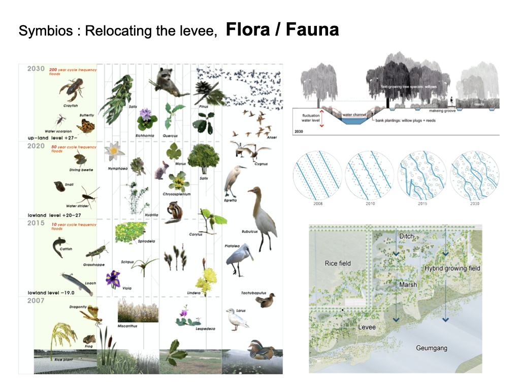
Natural succession area along the Guem River is proposed after removing the Levee. Expanded contact surface to the water and purifying waterways play a significant role in accelerating the natural succession in that area. Newly created aquatic ecosystem by subdivisions of the rice paddy supports the fundamental environment for vegetations. Frequent flood event helps the site to evolve naturally and have various biotopes and eventually to contribute to healthy biodiversity. The site is classified 4 different area including annual inundated zone and flood-free zone.
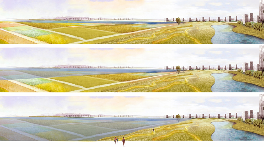
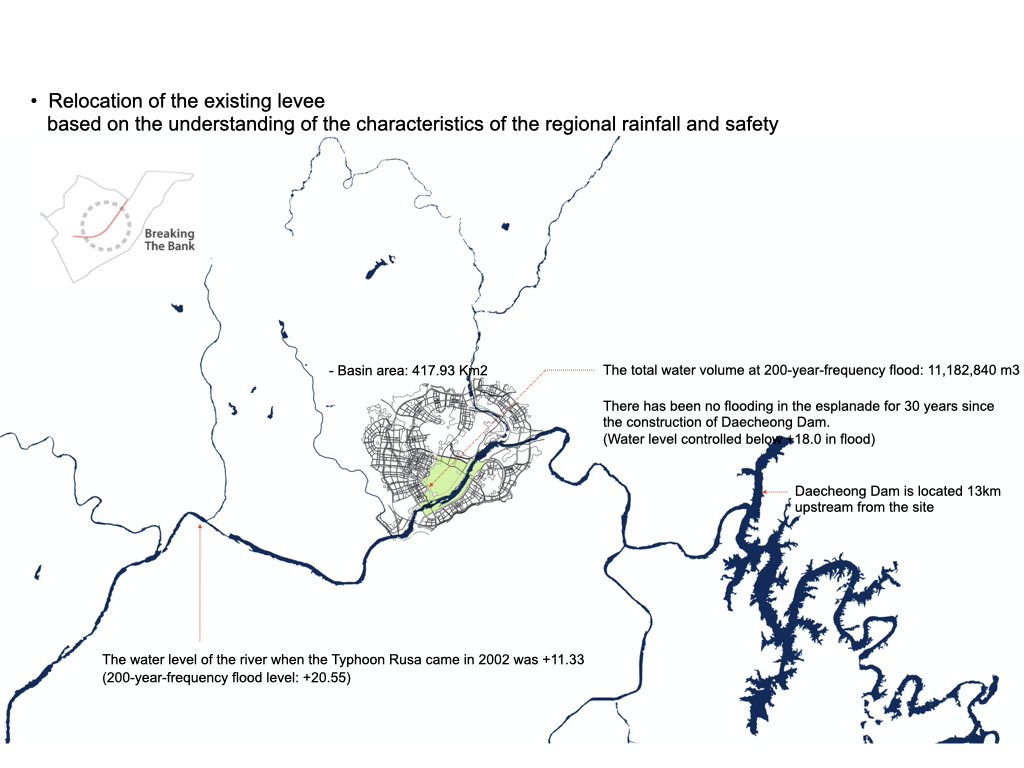
Besides the flooding level calculated for security, it is proved, by the interview with existing residents, that there has never been a flood event over +18.0 level since 1980 when Daechong Dam wasconstructed.
This indicatesthat it ispossibletocontrol thewater level inthe basin, and also that the possibility of water shortage should be considered.
(riverside +10.0/ the terrace land on the river +18.0/ top of the existing dike +26.0 ~ +28.0 / average level on the rice paddy +19.0~+20.0)
Area to Be Returned to Nature (Geum River)
Water goes back and forth to the area so that it eventually turns into a part of nature. It is strongly related to the Samki River region (the upper part of the site), and will help strengthen the sustainability of the whole city.
10 Year Frequency Flooding Area
Setting up a dike of level +21 keeps the area safe from 10 year frequency floodevent. This area is initially agricultural field, but gradually turns into a part of nature showing a sense of coexistence with nature.
50 Year Frequency Flooding Area
Setting up a dike of level +23~+21 keeps the area safe from 50 year frequency flood event. Relativelystable agriculture canbedoneinthisarea. Theenvironment friendly agricultural methods here recover this area and make it ecologically healthy.
200 Year Frequency Flooding Area
This area is located in over the level of +26.86, which is safe from 200 year frequency flood event. It has good accessibility to surrounded urban area and security for the urban facility.

생산의 대지 프로그램
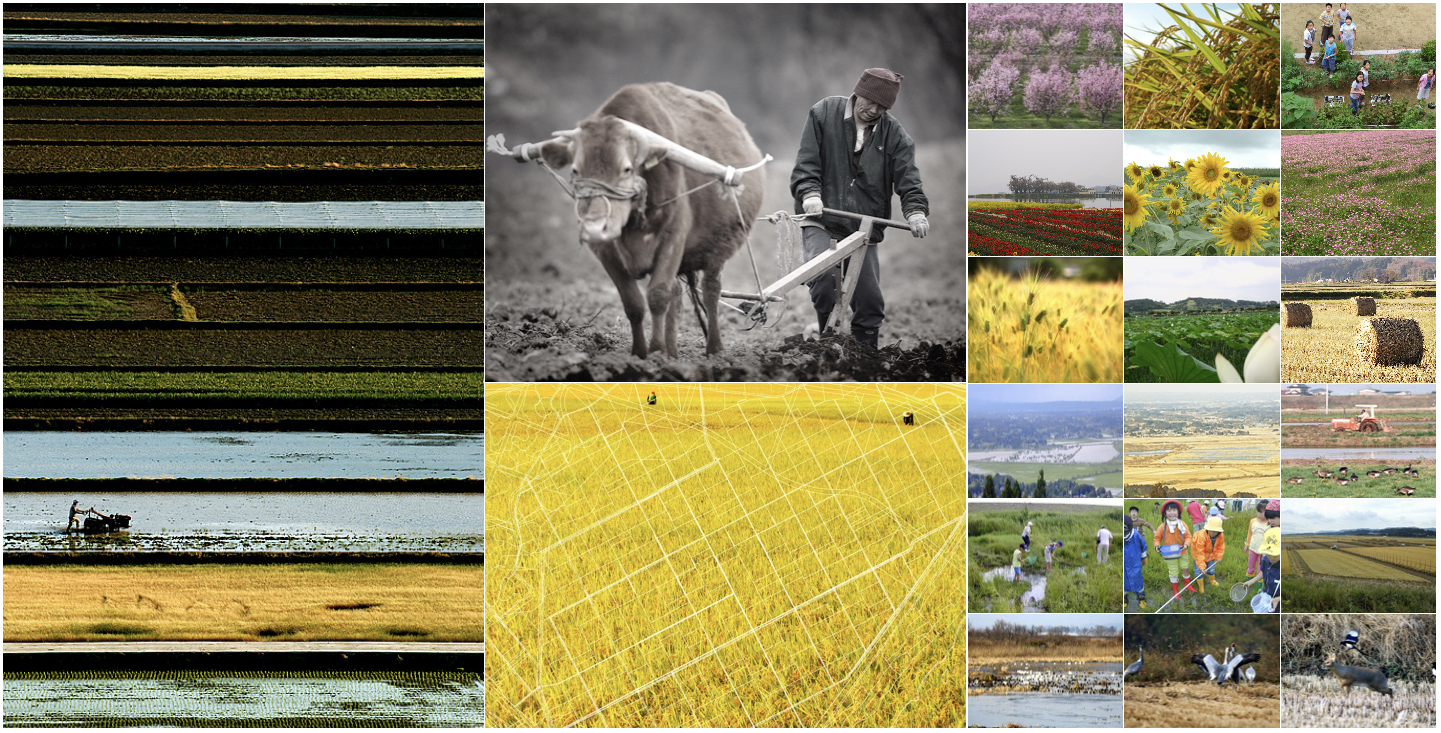
– 전통, 땅과 물에 대한 존중, 생산을 통한 땅과 공동체의 교류를 형성
– 생산을 도시 및 지역공동체를 활성화 시키는 강력한 도구이자 공원프로그램으로써 제안.
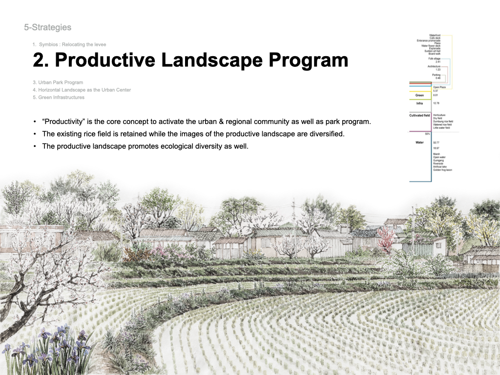
– 현재의 농지를 보전하되 다채로운 경관적 특징을 지니는 공원내 생산녹지로 분화화고 변모시킴으로서 생태적인 생물 다양성이 있는 생산적 경관을 형성토록 제안.
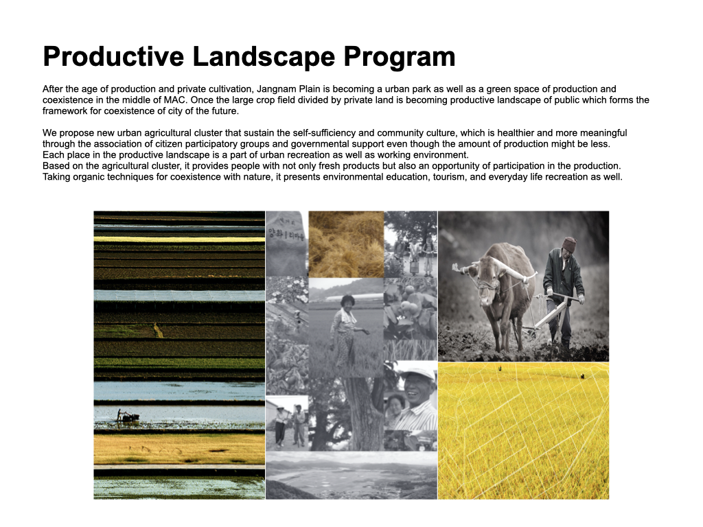
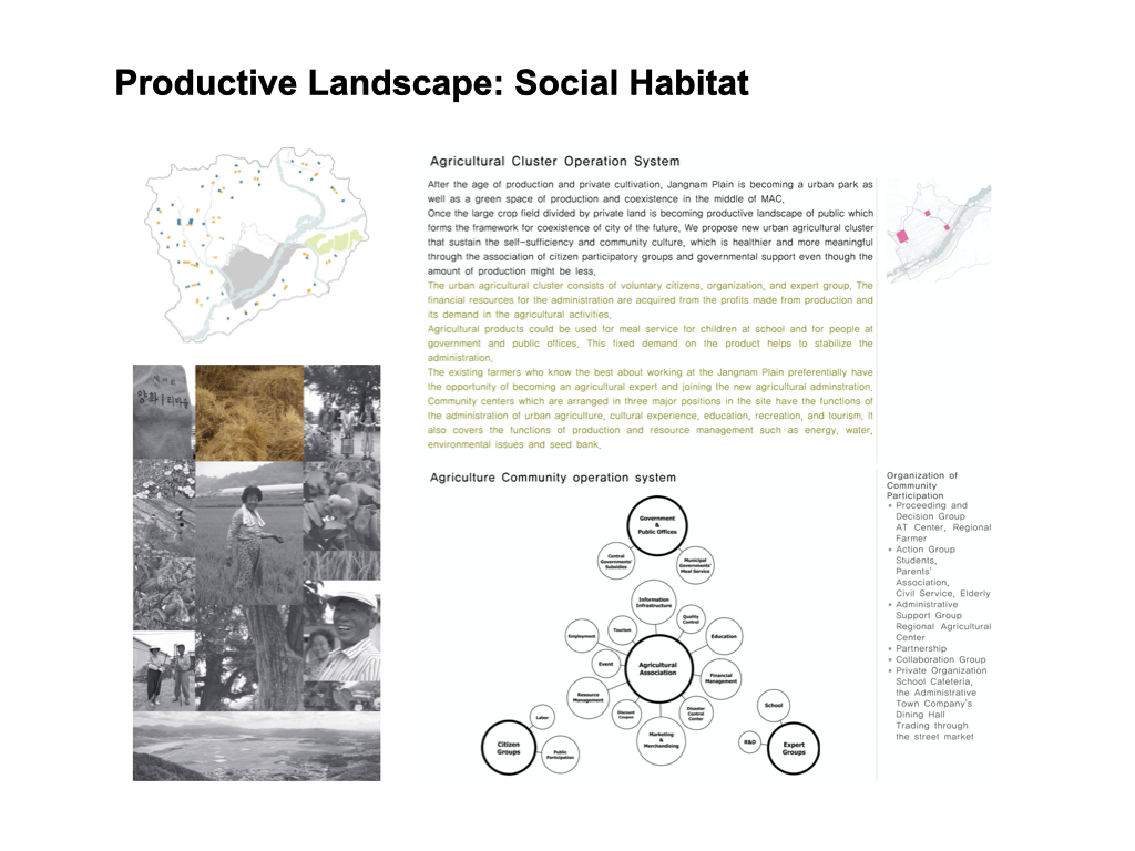
Productive Park Program
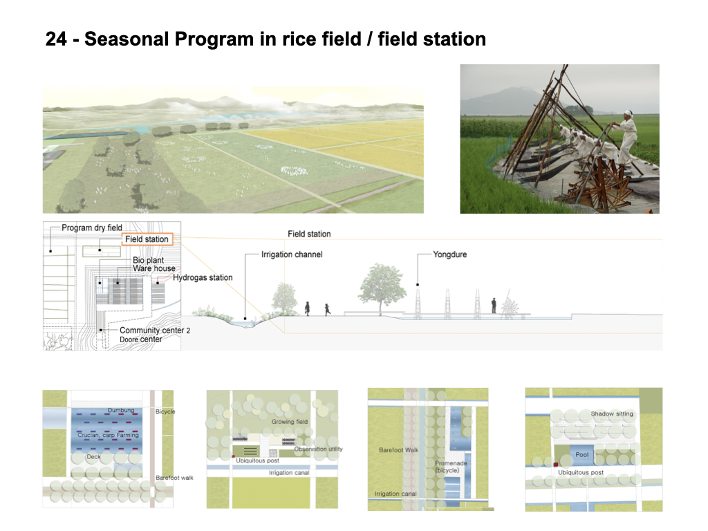
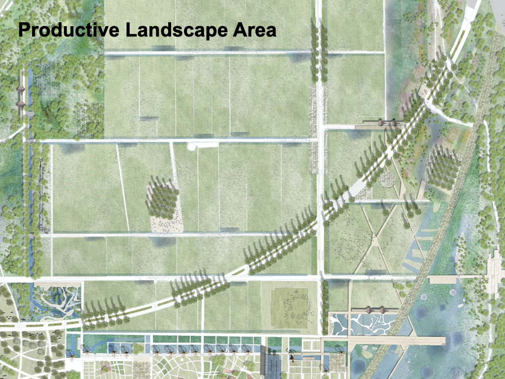
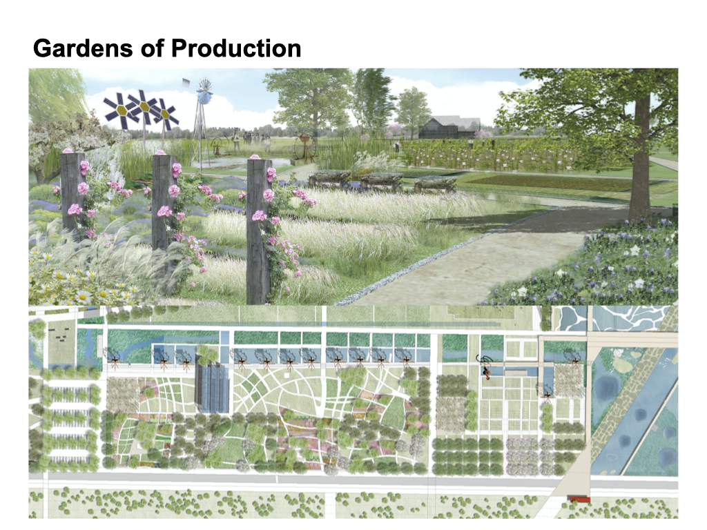
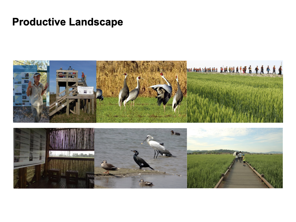
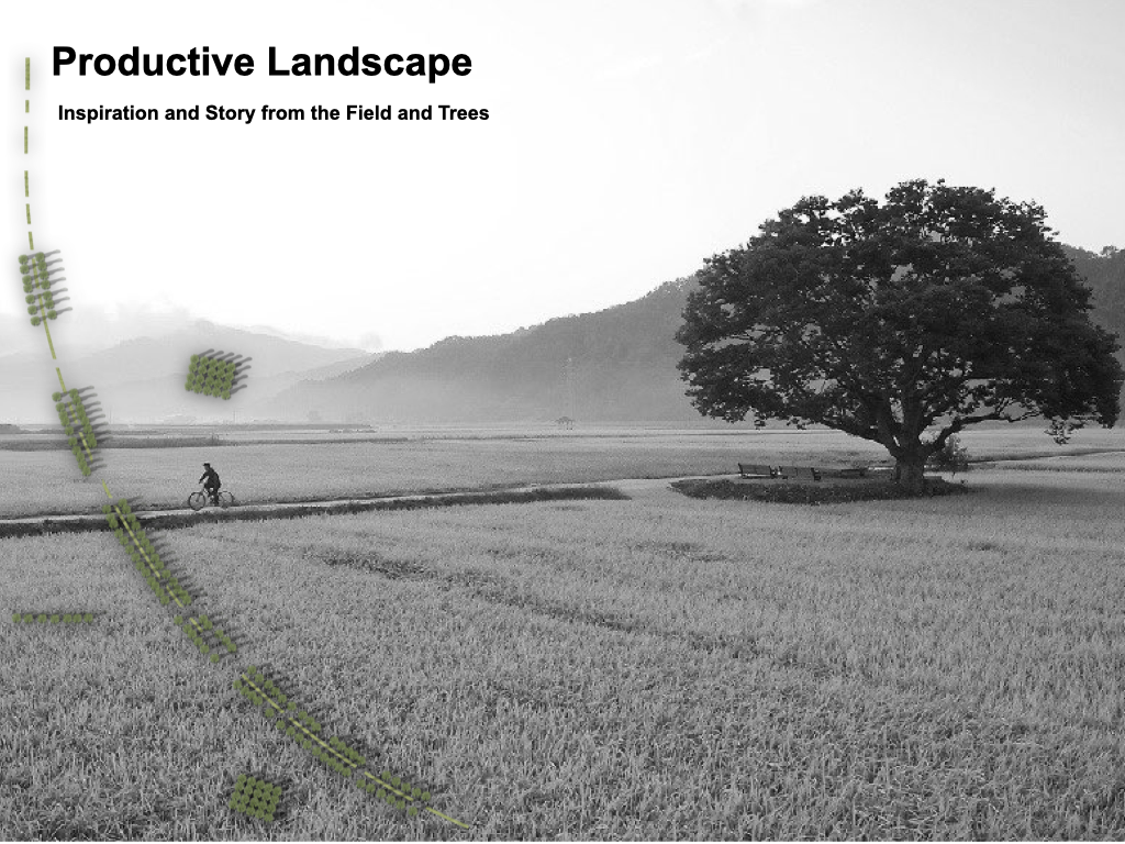
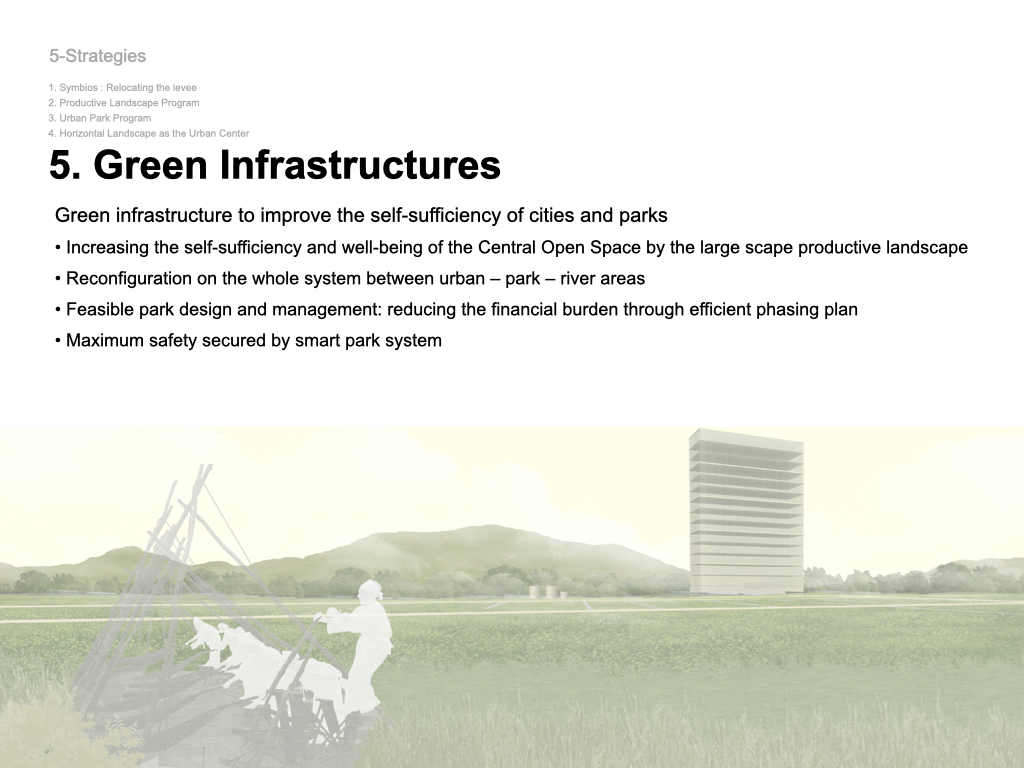
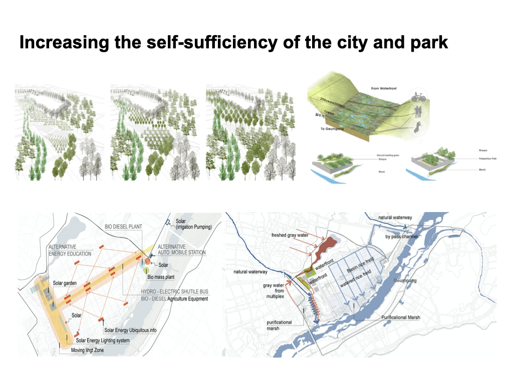
After the age of production and private cultivation, Jangnam Plain is becoming a urban park as well as a green space of production and coexistence in the middle of MAC. Once the large crop field divided by private land is becoming productive landscape of public which forms the framework for coexistence of city of the future. We propose new urban agricultural cluster that sustain the self-sufficiency and community culture, which is healthier and more meaningful through the association of citizen participatory groups and governmental support even though the amount of production might be less.
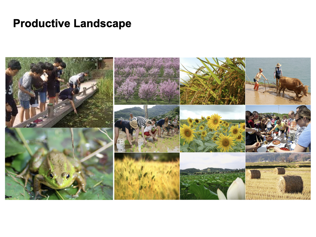
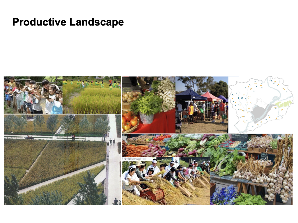
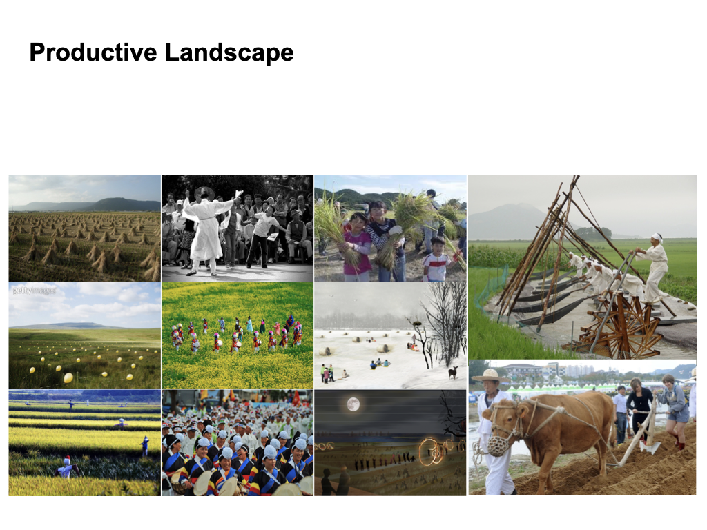
Each place in the productive landscape is a part of urban recreation as well as working environment. Based on the agricultural cluster, it provides people with not only fresh products but also an opportunity of participation in the production. Taking organic techniques for coexistence with nature, it presents environmental education, tourism, and everyday life recreation as well.
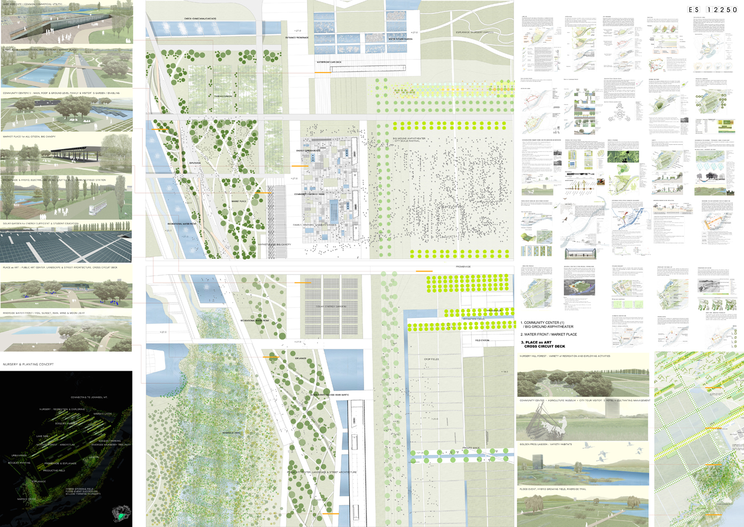
MASTER PLAN and DESIGN GUIDELINE for CENTRAL LAKE PARK in CENTRAL OPEN SPACE of SEJONG CITY, 2007 ~ 2009
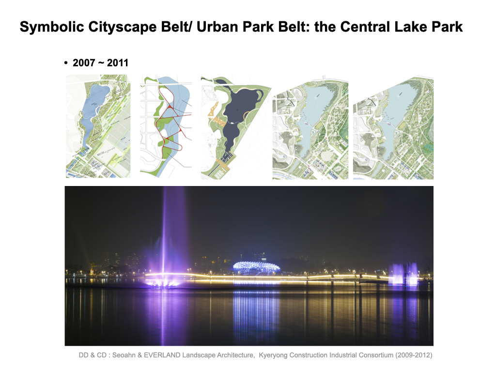
A separate turnkey competition called for design development and construction documents, and Seoahn & Everland landscape architecture won the first prize for this competition. Before turnkey competition, for one and half years, we made design development, budgeting, major facility design and guidelines were established and construction was completed. Pedestrian bridges over water, Stage Island on water, Water Flower Gardens, Swimming Pool, Artificial Beach, Sunken Parkinglot, Sejong Night Life and Fountains were the major themes to enhance the global city of Sejong.
DD & CD : Seoahn & EVERLAND Landscape Architecture, Kyeryong Construction Industrial Consortium (2009-2012)
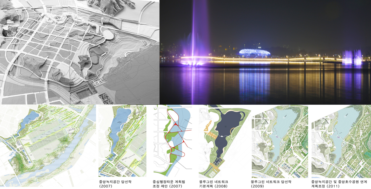
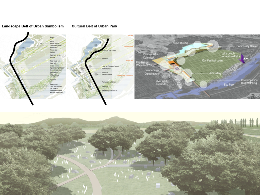
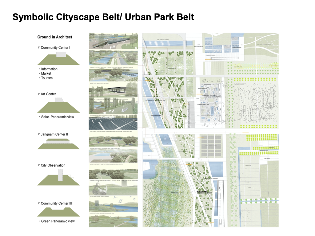
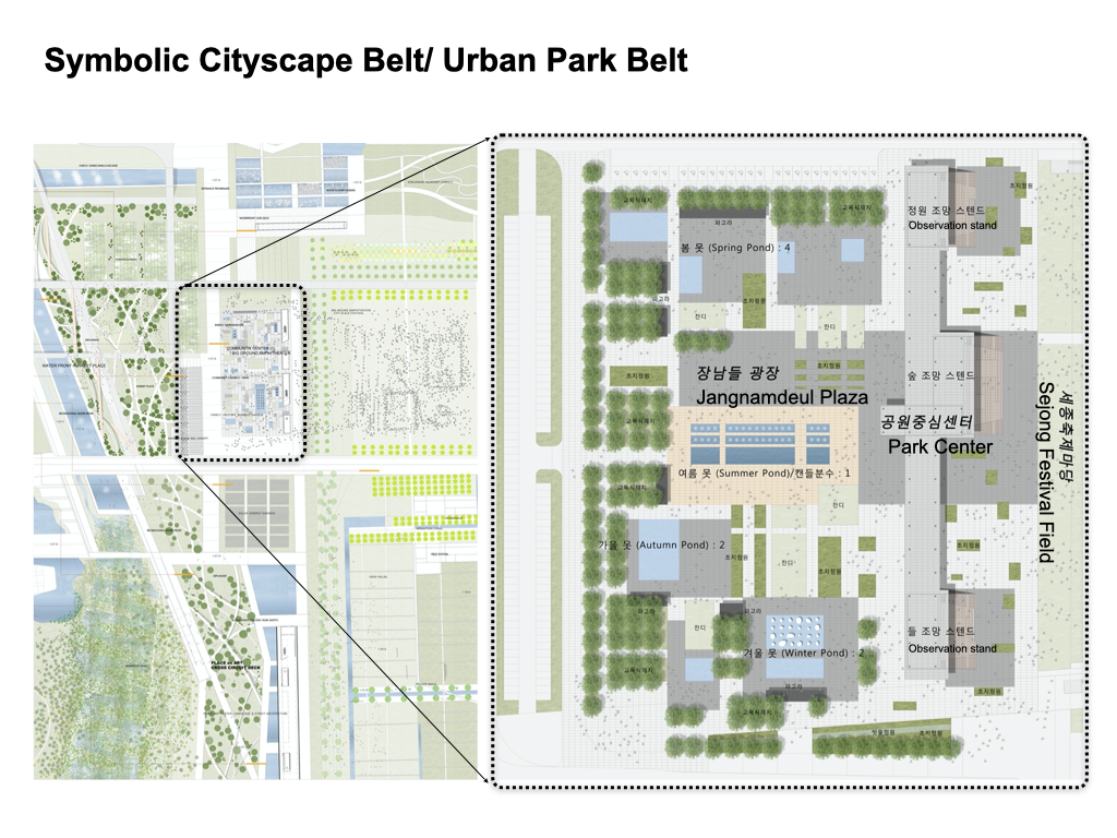
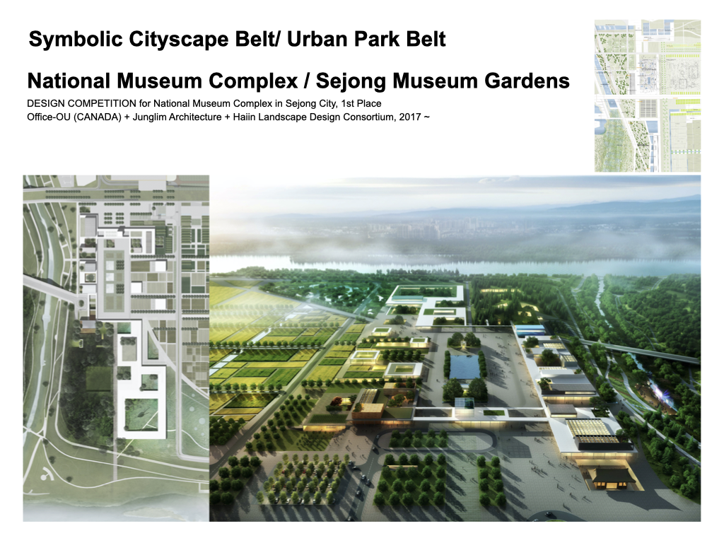
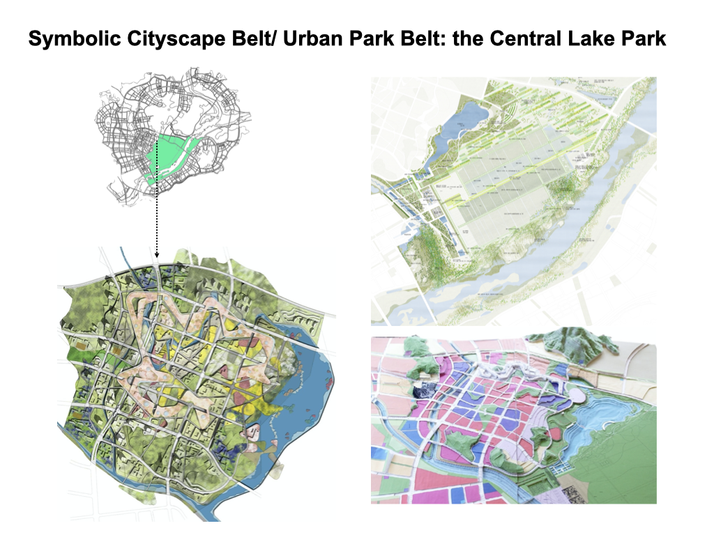
SYMBOLIC SCENERY, CULTURAL COMPLEX BAND & URBAN PARK PROGRAM BAND for SEJONG CITY, 2007-2012
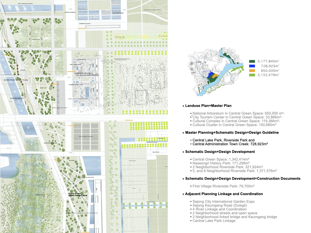
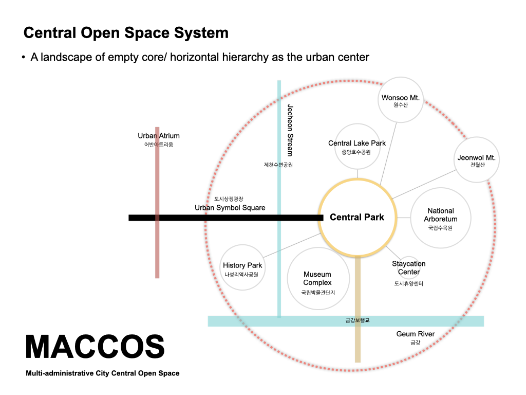
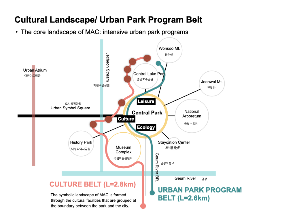
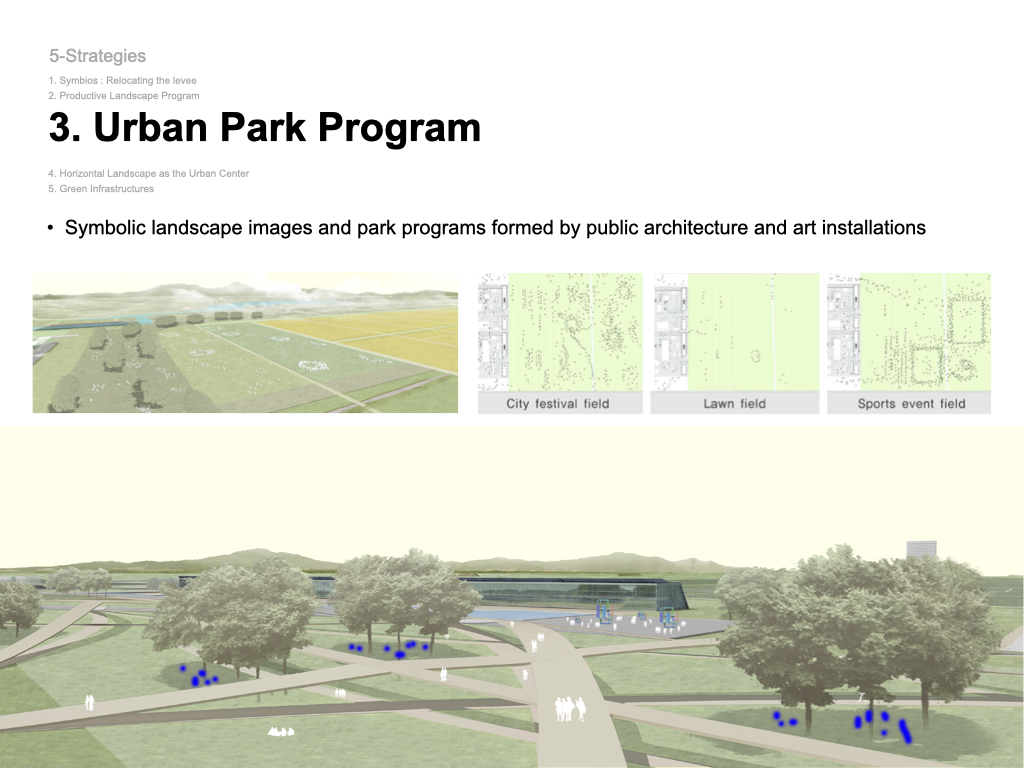
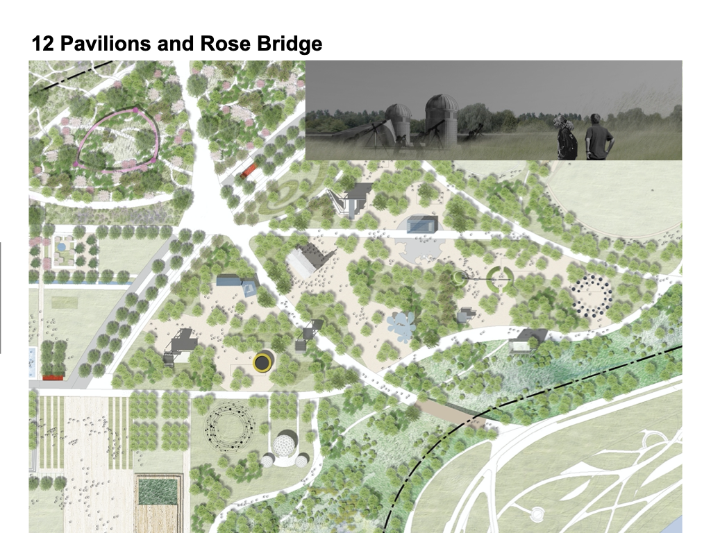
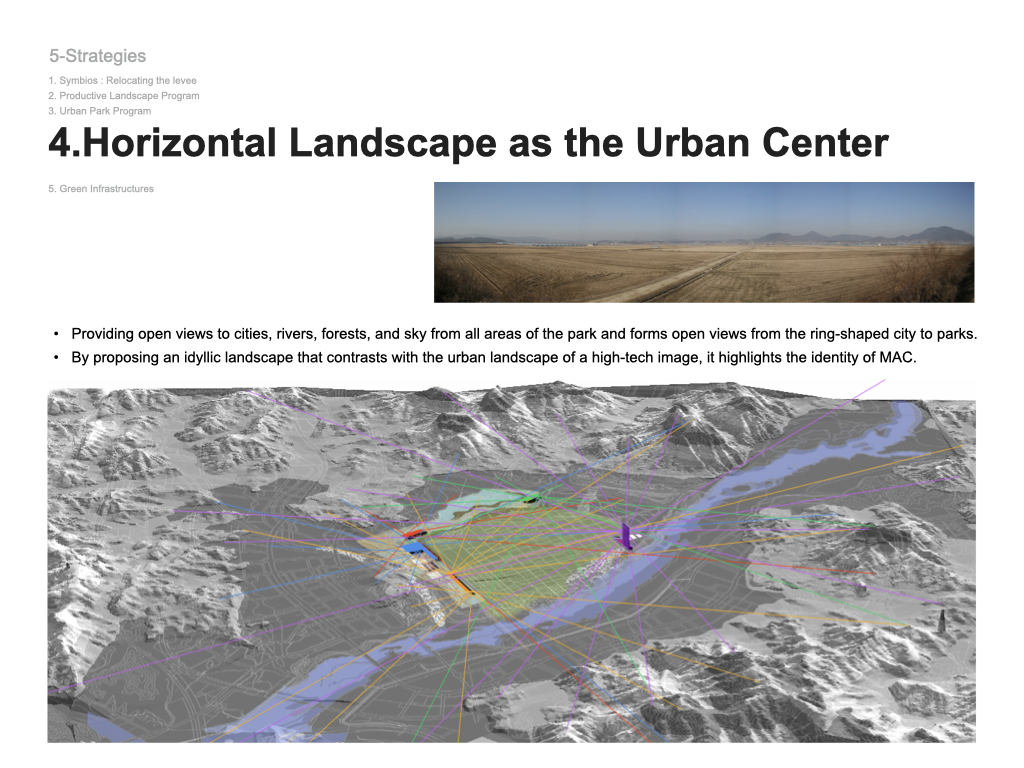
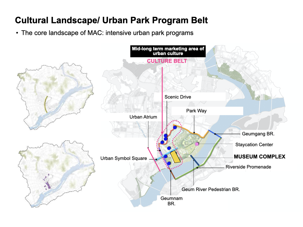
Another project opportunity sprung from the award winning project: Urban Park Program Band for Sejong Administrative Capitol. We created symbolic urban landscape programs of the perimeter of the Central Park of Sejong City. Our suggestions were to have a condensed program on an open space strip between the huge park green space and urban boundaries with a culturally symbolic cityscape yet allow accessibility from adjacent urban parcels. This band is also designed to connect Sejong National Street and a museum complex and weave through a mix-use parcel (119,366m²), hotel / urban tourism center (33,866m²), and park and leisure center (40,000m²) with 7 pedestrian and vehicular bridges and roads. 17 Cultural Buildings were proposed to centralize the central lake park as the center of the administrative capitol of Korea and to make Sejoing City a global city.
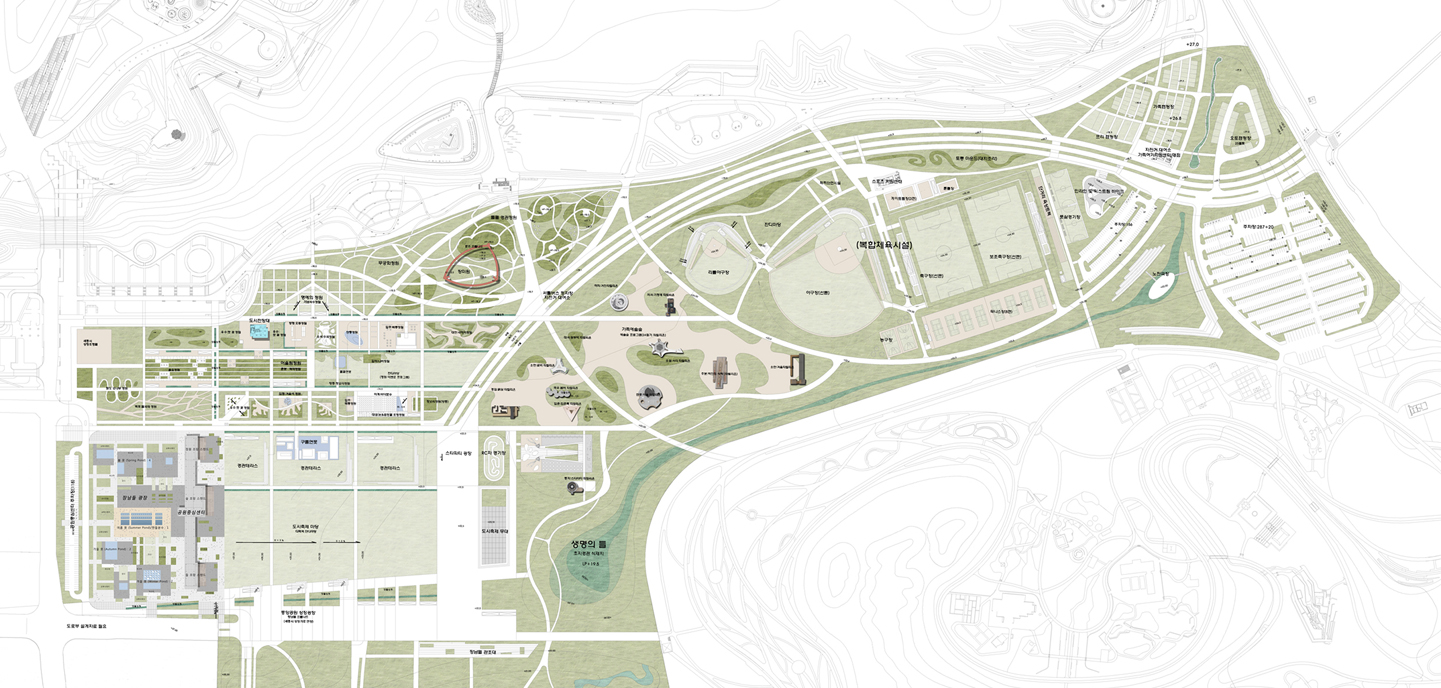
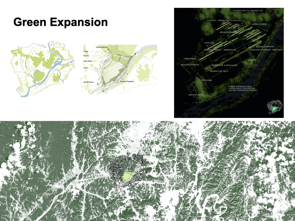
Sejong Central Park, Phase 01, 2007 ~ 2020
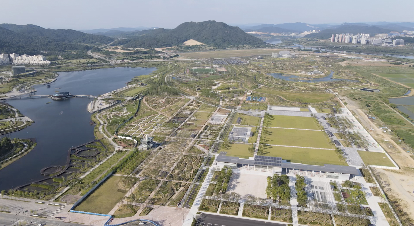
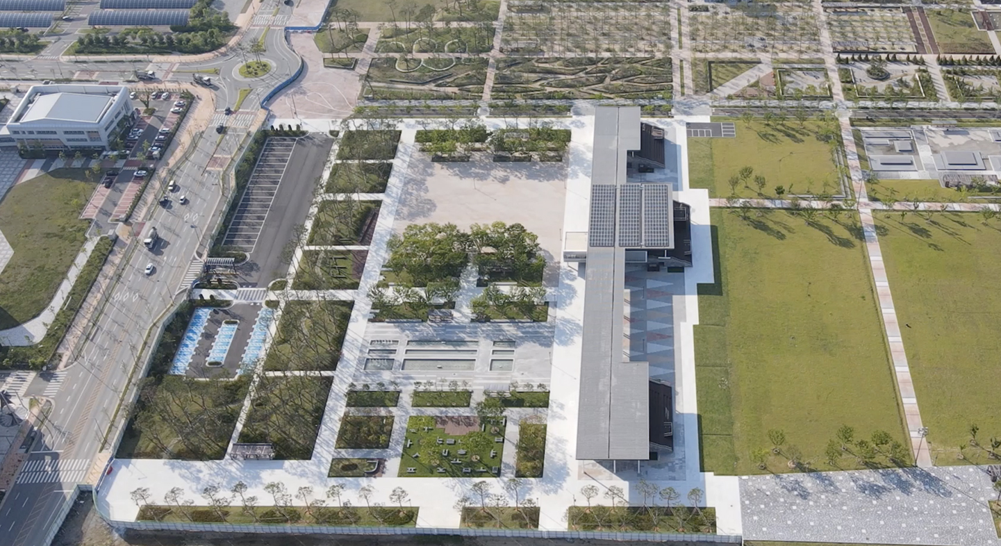
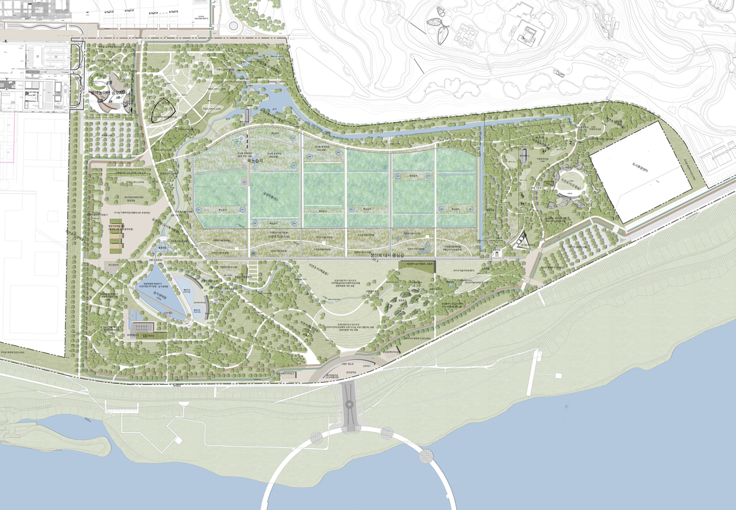
Sejong Central Park, Phase-02, 2007(2019) ~

